
(This will make more sense if you saw my previous post.)
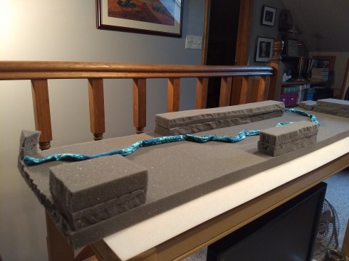
Upholstery foam foundation 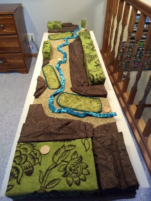
Foam foundation and details covered with fabric
Unlike most agricultural land in Indiana, which is flat and tillable for corn and soybeans, this special place is primarily woodland with a mile long creek. The “bottom” has three grassy fields (outlined with dark green). Everything else is woodland with various hardwoods that are 40-60′ tall. In other words, it is difficult to get perspective from any location.
I referred to the satellite map provided by the county government website and made MANY measurements of elevation plus distance. The elevation represented by the blocks covered by green and brown fabric is 850 feet (above sea level) and the highest of the rugged terrain. The blocks covered by brown fabric represents the rugged transition from peaks to valley. The creek bed is 760 feet (above sea level) on the west end, dropping to 740 feet with over a mile length.


Leave a comment